
We left The Box quite late, around 2 pm, so we didn't get too far. Just a few hours west down Route 60. This route, which not everyone knows, is the oldest route between the coasts, it just had worse marketing than famous Route 66. In 1926 it connected Virginia with Arizona and some time later Los Angeles. In the 1960's California got Interstate 10 and didn't care much anymore about "60". Now this route has its end in Arizona again and we just saw a small part of it in New Mexico. Route, just like almost any in that state, offers beautiful views. First there are desert mountains, then tiny trees, next huge woods, next rocks and majestic 3,000m high mountains.

It took us more or less an hour to get from The Box to space observatory VLA - Very Large Array. It's one of the most amazing observatories in the world, with 27 indepentent antennas, each of them with a dish diamater exceding 25m (82 feet to be precise).

They stand there, in the middle of the desert, buzzing, they sometimes move on the tracks and listen to the outer space. They are so sensitive, that at the entrance there is a sign requesting the guests to turn off their cell phones. There are no gates, security or fences. You just drive in, park by the Visitors Center, take some leaflets and go for a walk among the antennas. Unless you had too much whiskey a night before, then you can look at them while sitting in a car.

Not having any idea for where to stop for a night we stop at the first campground we see, just outside of a place called Pie Town. Jackson Campground not only is free but also we see a few deers and the stars are almost as beautiful as the night before.

If it only wasn't so cold - we see snow on our way…. But what to expect, after all we are almost at 7500 ft / 2500 m above the sea level.

We sleep almost exactly on Great Continental Divide: from now on all the rivers we see will be going to Pacific. In the morning after scrubbing the ice from car windows we go to Pie Town. It was settled in 1930s and once had a population up to few hudred. You can see the pictures from late 1930s here.
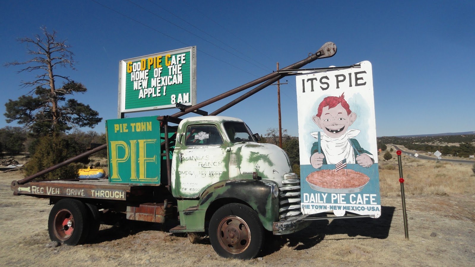
Nowadays in Pie Town there are just a couple of houses and two cafes, one of them open May till October. We stop for a coffee and - of course - pie. In the beginning we thought that the name is from Spanish "pie" - "foot", and current interpretation is just a marketing, but no. From the very beginning it was all about pies. They were a sweet addition to hard work in the field.
In the beginning it was a pretty nice place considering it was the beginning of Great Depression. In the winter there was a lot of snow which melting was feeding streams, and those would water the crops. Fertile soil gave job to few hundered people. But in the 1950s climate suddenly changed. Winters got milder, climate got more dry. There was not enough snow and plants didn't want to grow. First winter everyone thought it was just an anomaly, second one - people got worried, and after the third people started to leave. A handfull of them stayed until 1990s, but now there are no original Pietowners any more.

We spent over an hour in Pie Cafe. We talked to Michael, who is - as his card says - Head Chef/Pie Master/Chief Bottle Washer. He came to New Mexico from the East Coast 25 years ago for a while and stayed for good. We're not surprised. We just wanted to stop for a quick coffee and we spent there almost two hours. It seems to be enough to look like locals, as newcomers ask us about good bike trails in the area. Next time we'll come up with some good one, like "Well, go down 3 miles, take left by the broken pine tree, then head straight for 30 miles and then ask someone".

Finally we leave. Our next stop is a town called Quemado, with two gas stations (only one of them open, just to make the choice easier) and about hundred Indians. We see just a few teenagers, they all are overweight and drink red bulls. We get the full tank of gas, after all we have no idea where will have the next chance. We head north by Route 117 to El Malpais National Conservation Area.
Pretty soon we reach Lava Falls on the left side of the road. This time it's daytime, so we finally get to actually see lava. There is a trail through lava beds marked with stone markers. It's worth a walk, as the beds are not that old, just about 6 thousand years. Lava in many places is cracked but you can easily see how it spreaded, waves are easily visible as well as how it was finding all dips and places were lava flow into bowls and then subsidented. The route itself is very picturesque too as it leads on the very edge of lava. Sometimes it feels like it's still spreading and we need to run away. At least the car and the road are good.

Just a few more miles and on the right there are beautiful sandstone walls, strongly contrasting with black volcanic rocks. It's The Narrows. There is also a trail and from the parking you can see La Ventana - the biggest natural arch in New Mexico. It's worth to take a 10 minute walk to see it closer.

After a few days away from civilization we decide to stay at paid campground - we have to fill our tanks with water, charge all the electronic devices and do the laundry. And check what time it is - after zigzaging through time zones every watch we have is set up to a different time. Plus there was a time change to daylight savings on the way (which, just to make it easier, is respected in all Arizona except for Navajo land….).
Let's just say that for many days now we have no idea what time it is. Well, as we say in Polish, happy people don't check the time. They sometimes are glad to look at a map to see where are they going to end up, though. That's how we ended up in Grants, our first stop at Route 66.
No comments:
Post a Comment