8/27/2013

Yellowstone, part 1

We are always so amazed by everything that for a change we decided to complain a bit. After all we're Polish, that's what we do.

The same day we planned to move from our great free spot near Grand Teton to Yellowstone we found a free campsite just by the border of the park. We even read about it in official brochures of Yellowstone and Grand Teton. Campground was supposed to be by Grassy Lake Road on John D. Rockefeller Jr. Memorial Parkway. It's the area that Rockefeller gave to Grand Teton National Park. Meanwhile on Grassy Lake Road there was a sign "road closed". Visitors center nearby was closed too. And all because, as the note on the door said, budget cuts.

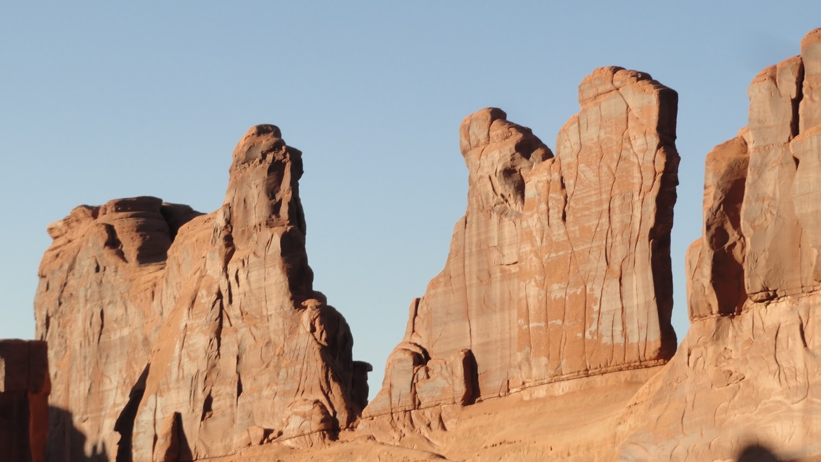
At Shieffield Creek Campground
Crisis? Oh, come on! Closing free campsites due to crisis? They should open more of them instead, not to discourage people from traveling… We didn't get discouraged though and we went to a hotel to ask whether there are any other free campsites in the area. Yes, there is one, said young man in reception. You have to go back, turn onto forest road and cross the river... No worry, it's only foot deep. Ok, that can't be difficult. We went back, turned and, with our eyes closed, crossed it. It was our first river crossed with a trailer.

There was a campsite, not really free - it was 5 USD per night. Not having other choice we stayed. To make it even worse campsite was full of bloodsucking beasts, mosquitos that were so bad that every time we left the trailer it felt like being in one of more drastic scenes of "The Walking Dead"...

Yellowstone
Ok, enough with complaining, just wanted to give you a sample of Polish specialty:) Anyway, it seems this is the cheapest camping option near southern border of Yellowstone. The creek we had to cross was shallow enough not to get into the trailer or car, but deep enough to make our adrenaline level jump. Still, nothing comparing to hurricane Sandy. And on top of mosquitos there were also toilets, picnic tables and fire rings. Good enough.

Still Yellowstone and not Shieffield Creek Campground
If you'd like to stay there here are the directions. Going north on "191"/"89" from Grand Teton to Yellowstone, some 2 miles before the border of Yellowstone, just before bridge on Snake River and some 1/3 mile before Flagg Ranch and Grassy Lake Road you have to take right. Follow the road by the river until you have to cross it and once you do there will be campground with sites and self paid station. It's a bear area, there are warnings not to leave food outside or in a tent. We haven't seen any (un)fortunately, but there are some wild horses running around. 

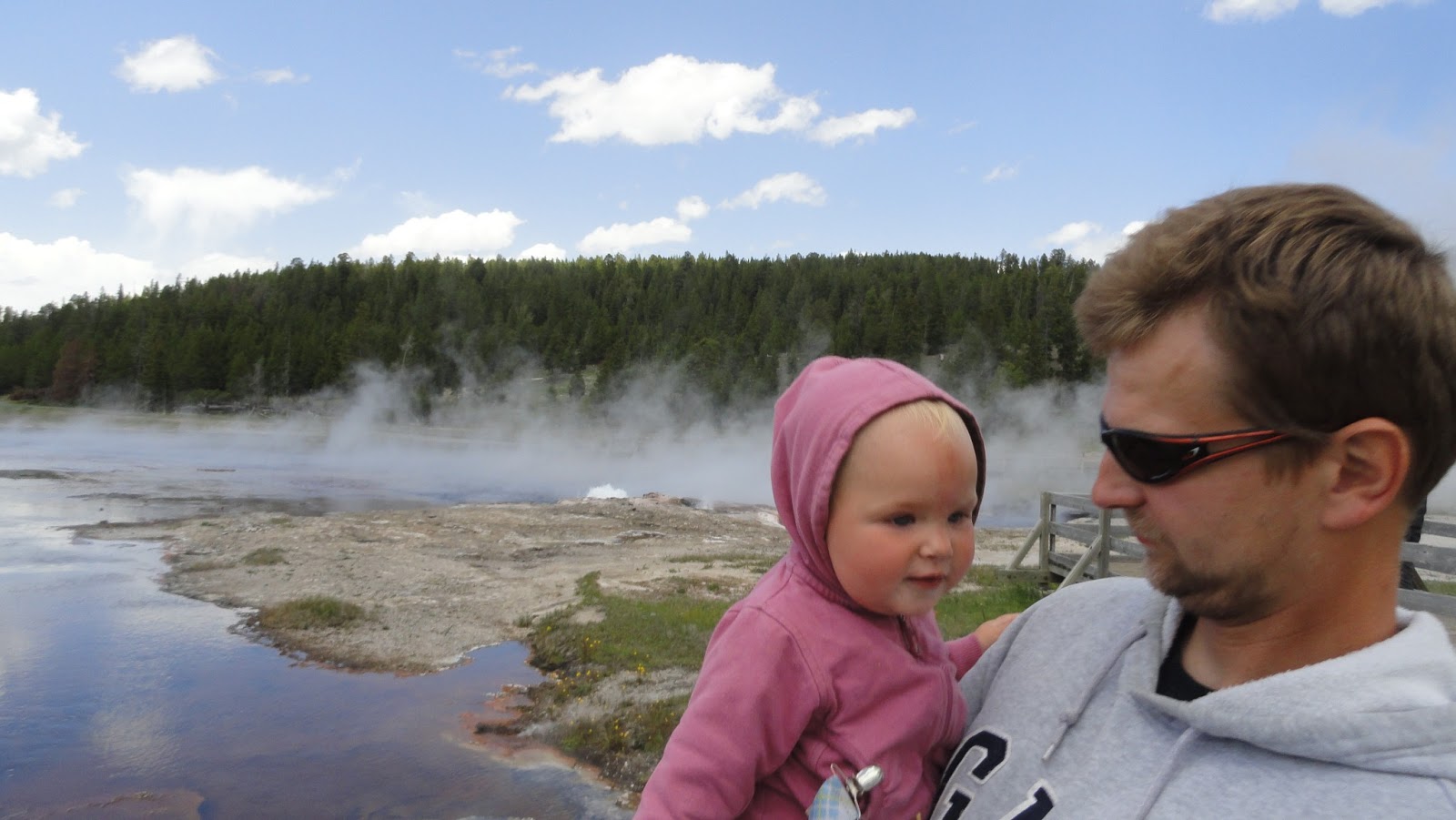
Maciek next to Yellowstone River
Next morning we went to Yellowstone. First impression, from visitors center, was not too good. Yes, there is a bus but it's 25 USD per day, to our standard question about what to see ranger replied with just couple sentences and when we kept asking she told us to get a map (50 cents each) and brochures. So we did. We sat down with a map and got overwhelmed by the size of the park.


Where to go? What to see? It's not easy. The park is really huge. It's some 60 by 60 miles, the loop going around is more than 100 miles. It's impossible to do it in one day. But you can do for example one third of the loop in a day, seeing all the attraction on one side of the road,  and than go back seeing attractions on the other side. 1/3 is a maximum for a day, no matter whether you're there with kids or not. Our 4 days in  Yellowstone was not enough. We will be back there for sure.


We read that when first travelers who got there were talking about what they'd seen nobody would believe them. One of them said that rivers in Yellowstone flow so fast that water starts boiling from friction. We wouldn't believe it if we didn't see it. Not knowing (as usually) what to expect, we thought there would be a few geysers spread all around the park. After seeing what we saw we're just wondering why the first travelers didn't call it (like settlers from Utah would do) for example Devil's Kitchen, Boiling Satan's Guts or something of that sort...


Yellowstone bubbles, shimmers and boils. There are lots and lots of geysers and hot springs, you can see steam all around, water and smoke jets up from underground, plus the colors are stunning, the hottest springs are clear blue, cooler ones are inhabited by orange bacterias/algaes, in between temperature makes water green (as photosynthetic organisms can handle the medium heat), there are also bubbling mud pools, wells, fountains and terraces with boiling water, smell of rotten eggs in the air... And rivers, lakes, mountains, woods, wild animals including bisons, moose and bears.


Only the area of the most famous geyser - Old Faithful, called Upper Gayser Basin is a few hours walk. It's crowded, but just near the Old Faithful, few minutes away and it gets more lonely. Yellowstone, by the way, is a place we got truck the most sby cultural differences. If we come across an American on a path, he/she would stop far before us and stand back to let us through, apologizing, saying something nice to Kalina or Maciek or having a little chat with us. Europeans would smile and make way but they don't get in touch. Asians have two strategies. If they are not in a hurry they would smile or say a few nice words about the kids. But usually passsing by they look like running through metro in Tokio, squeezing through, pushing around, jumping over stroller, whatever it takes.


Old Faithful is now a respected symbol of Yellowstone. But it wasn't always like this. After being discovered by new comers from the East it used to be ... washing machine. When it was quiet they'd throw dirty clothes in and then it would spit out clean things up in the air. That was in 1882, 6 years after national park was established. In the beginning it was a reallly wild west here. There was problem with poachers, it was difficult to control such a huge area. After all, with some help from media, it was solved. One reporter happened to be in Yellowstone, when one of the poachers was caught with six heads of bisons he killed. One picture, one article and it was enough to get Yellowstone more fundings. Good old times... Maybe if we took a dramatic picture crossing the river with Eddie, they would reopen this closed free campsite…


But there is really nothing to complain about. Yellowstone is a great place and despite our fear regarding the size of it, it is very user-friendly, also for travelers with kids. There are many places you can see during short walks, up to 15-20 minutes round trip. Almost all places are stroller accessible - there are boardwalks to walk around geysers. It's because of safety - thermoactive area is covered with thin crust, there were many accidents in the past due to falling into boiling water - there are warning signs founded by parents of 9-year-old who died in 1970 when he got to close to geyser, crust broke and he fell in.

We were more careful, although one time we got tempted to check how hot is the water. We did and people around started shouting at us right away, not to touch it, we'll get scalded, bacteria will eat us alive and acids will burn our eyes out. Bit dramatic, but maybe it is better to keep your hands away.

Besides Yellowstone has natural thermometers. Where water is bubbling we can expect it's over 200F, as this is the boiling temperature at 7200 feet (don't try to boil potatos when camping in or close to the park, it was a really frustrating experience). If it's beautiful blue but doesn't bubble, it's probably less than 195F. Orange and green is much cooler.


So we got more careful and and we didn't touch anything anymore. We were driving around and walking and driving and walking... We will try to write everything about it in next entry. 

Meet us in Warsaw!

If by any chance you're in Warsaw on September 22, 2013 at 4 pm, come to Klub Podróżnik, at Felińskiego 37, we'll be showing photos and talking about our journey. Hope to meet you there!


8/22/2013

Big Tit

Grand Teton National Park was on our list of places to see since our hosts from luteran campground near Cedar Breaks told us a bit about it. Once they were on their way to Yellowstone but passing through Grand Teton they loved it so much that they didn’t go any further. They went to Yellowstone some other time. Before that we were planning to see Grand Teton Japanese style - pass it by taking pictures on the way. 
Maybe if someone told us what its name means it would be easier to catch our interest. Grand Teton National Park means Big Tit National Park. How it’s enough to name something in French and right away it seems so sophisticated… Although not to shock those more sensitive readers we’ll stick with the original name.


From Evanston on Utah and Wyoming border we had some 200 miles. There are two ways to go north: the shorter one is "189", the other goes slightly east but it’s designated as scenic byway. In Welcome Center though they told is that it’s not so much more scenic than "189" but for sure it’s more difficult for a car towing a trailer. So we decided to take the shorter one, which was nice but not really memorable.

Wyoming surprised is with its Welcome Center. Except maybe for the fact that they don’t allow overnight camping there. But there was a pretty cool playground, free internet, some interactive exhibits and a horse that Maciek could climb and feel like a cowboy. Pretty civilized is this Wild West.


Using internet at Welcome Center (we don’t even hope for T-Mobile coverage anymore) we found a place to stay for next couple nights. There are a few free campgrounds in Grand Teton to be found on freecampsites.net and those are one of the best places near national parks.

We stayed at the base of Shadow Mountain. It's quite easy to find it, although first time we missed it. Going from the south you have to take right onto Antelope Flats Rd not far behind Moose Junction and go a few miles on an asphalt road until you get to a stop sign, than take left and follow a road paralel to national park - it’ll soon become a dirt road. After 5-10 minutes you’ll get to a place with an information board and metal storage for food (if you have a tent you have to keep your food there not to tempt the bears). It's informal Forest Service Camp. Be prepared that the road will be rough, after rains impassable. Camp can be crowded but quite as everyone is just enjoying the view.


There are really three campgrounds in the area. The one we chose was by the information board. It’s quite popular and the easiest to get to but the spaces are very uneven. A bit further north, on the right there is another spot for camping, but it’s more difficult to get there. Even as it was quite dry and we were driving there without our trailer we thought that our jeep may get stuck. And there is another pretty place up the mountain, right (east) from the place we stayed at. Going up though is tricky and it can be difficult to turn around with a trailer. We wouldn't recommend it for anything larger than a small B-Class.

The view from Shadow Mountain is amazing, but it was pretty great from where we stayed at too. Tetons are really impressive: from our trailer windows (we skipped bonfire this time as mosquitos were terrible) we were looking up at the peaks over 13,000 feet high. Plus the campsite is east from there. In the rays of the setting sun they seem as if they’re on fire which makes them look even more dramatic than at any other time of the day.


We spent in Grand Teton NP whole next day. After Utah heat (last few days temperatures at night were around 80F, and around 100F during the day and it’s not easy to find a shade there) it was a pleasant 80F and slight breeze. We drove the "scenic drive", we took some pics from view points, we took a few walks by lakes. Pretty views, fresh air, green and blue before our eyes, birds singing (what a change after Utah!), plus antelopes, bisons and bear warnings everywhere - in the gift shop they even had a single-use spray against bears for only 65 USD. We were also impressed by…visitors center by Moose Junction. Brand new, fancy, well designed building, multimedia presentation, everything well thought through to the last detail.


And what is there to see besides visitors center and viewpoints? Well, let's say at first what we didn't see. We didn’t take a ride to the top of Tetons. We decided 26 USD per adult and 13 USD for Maciek is a bit too expensive. There are free cable train rides from mid-June but we were there too early. We went round a part of Jenny lake. We decided to skip the ferry (12 USD - adult, Maciek - 6 USD) and hidden waterfalls on the other side of the lake (without taking a ferry it’s over 5 miles round trip). 

We took a walk in Colter Bay but we don’t really recommend it as the path leads through the woods along the lake, with no mountains view. There are nicer paths there you can walk with an amazing view as a bonus. Grand Teton has a lot of walking trails to offer but only couple of them are stroller accessible and a walk with Kalina longer than couple of miles is a real challenge. We saved our strength for Yellowstone.


Grand Teton NP was being created over many years. As far as Yellowstone is proud of being the oldest national park in the world, with Grand Teton, which is a part of Greater Yellowstone ecosystem, there were lots of problems from the very beginning. The area is a result of series of uplifts and erosional sequences that created the Rockies. This process didn't stop and Tetons are still going up while the Jackson Hole, called Pierre Hole by first French fur trappers, is sinking. It's not going down thanks to new sediments being brought by glaciers in the past and now mostly because of our most favorite American river - Snake River.


Jackson Hole is not a really good place to live. Valley surrounded by mountains was periodically inhabited by Indians until the beginning of 19th century, when white faces started exploring the area. Later it was used by trappers hunting beavers for their furs. At the end of 19th century when Yellowstone was already under (not the best) federal protection, farmers came by. But the season there is short, winters long and severe, so just after two decades few ranches in the area realized where the money is coming from and they switched to "dudes". Dude Ranch is a ranch that instead of cattle takes care of tourists and that’s what became popular in the beginning of 20th century in Jackson Hole.


Next years it was for some a history of federal invasion supported by Rockefellers’ millions, and for some a battle of nature lovers to found a park. In 1929 Grand Teton National Park was founded, but it was limited only to mountain peaks of Teton Range. The valley was private owned and the owners refused to include their land to the park. They had an ally as the state of Wyoming was against the park enlargment.  

The federal goverment also had a powerful ally. Mr. John D. Rockefeller Jr. came once to the valley and fell in love. Soon afterwards a mysterious company started to buy land in the area. After it had more than 35,000 acres, Rockefeller came out and admitted that he is behind the purchase. Then he offered the land to federal goverment to add it to Grand Teton NP. It wasn't easy as he had not only Wyoming and private owners against him but the Congress as well.


In 1943 Rockefeller gave an ultimatum, either national park would be created or he would sell all the land on free market. In response the goverment forced a compromise and created a national monument on the lands donated by Rockefeller. Wyoming even took federal goverment to court bu finally seven years later after more talks between interested parties national monument was abolished and the valley was incorporated to Grand Teton National Park.

Entrance fee for 7 days is 25 USD. Not cheap but it covers entrance to Yellowstone too. Besides, with our annual pass we get in for free. Not a nice surprise was the price of all the "additional attractions". After all the parks with free shuttle buses we took it for granted that cable car to the top and a ferry that in 10 minutes takes you to the other side of the lake will be either free or at least inexpensive.

On the other hand it was the first park that gave information about free campsites in the area, and our campground was visited by a park ranger who came to wish us a good stay. Of course we reacted in Polish way "damn, guy in the uniform is coming, what did we do wrong" but he just came to say hi and assure us that if we have any questions or problems they were there to help.


Next day we went to Jackson for couple of hours to use internet, as we knew we wouldn’t have it over next few days. "Comercialized" Moab is nothing compared to Jackson. It is full of restaurants, cowboy and travelers shops, cars get stuck in traffic even the park and pavements (mostly wooden, in arcades of buildings, after all it’s almost Wild West) are crowded. But in Moab we had coverage and 4G and here we had to look for a place with WiFi which was not that easy at all.

We didn't like Moab and we didn't fell in love with Jackson. Next day early in the afternoon we headed to the last big national park on our route …

8/17/2013

How we did not see the dinosaurs

After over two weeks of enjoying red rocks it was time to move north. It took us a while to decide which way to go: take an interstate through SLC to Idaho and from there head to Wyoming or take a steep and difficult "191" and go through Dinosaur Diamond, visiting on our way two dino-museums and one national monument. 

Dinosaur Diamond is a name of a scenic byway crossing eastern Utah and western Colorado. It runs from Moab north on "191" through Green River and Price to Vernal. From there it goes back south touching Colorado on "40" and "139" and finally along Colorado river on "128". The whole thing is 512 miles long, we were planning to do more or less half of it - from Moab to Vernal. 


We were just a little bit worried, although dinosaurs were tempting, high mountains, due to lack of trust in our car, were discouraging. But at last we’ve decided to take a risk. After all we don’t see dinosaurs every day. 

We go tup quite early, before it got really hot (last few days were difficult even for us, and we are, lets say, thermophilic), and went directly to Price. We skipped Cleveland - Lloyd Dinosaur Quarry. It’s a little bit outside of the highway, there is a dirt road leading there and we decided it was too far for us. Too bad, as we read later that it’s a fascinating place where you can watch dinosaur skeletons put toghether and bones left in the ground. Some of the excavations are in the buildings, and there are over 20 different exhibitions. Probably if we read the brochures more closely we would decide to stop there after all.


In Price we stopped only in Utah State University Eastern Prehistoric Museum. For 6 USD per adult and 3 USD per Maciek (Kalina goes in for free) we visited not very interesting museum with some skeletons and few Indian exhibits. Then we went to visit a local information center when on top of maps and brochures we got 15 USD worth of vouchers to JBs restaurant where we stopped for lunch. Thus we waited through the worst heat and around 5 we moved on. Of course according to our plan we should’ve been some 100 miles further by then but we are already used to the fact that our plans need corrections quickly.


So we left Price and we headed on. We were driving and driving and driving, the road looked a bit like in California - winding among green hills, we even started unconsciously waiting for an ocean to show up at next turn. We were driving for a few hours. It did seem suspicious at some point that we kept driving against the sun, but we managed to racionalize that. And then Pawel asked "so on this junction, of 6 and 89, which way do I turn?". What? Wait a minute…it was supposed to be "191"!!!


We stopped on the side of the road and we looked at our map. Somewhere on the way, busy with enjoying the landscape, passing by road work (Pawel) and translating the blog into English (Ola) we managed to miss the fork of "6" and "191". To make it even worse, our GPS said that to Vernal, where from Price it was some 110 miles, now we have 150 by maybe a bit better highway 40, but still we have to cross the mountains...


We decided to call it a quirk of fate - maybe this steep "191" was just not meant to be. Dinosaurs can wait. Too bad we didn’t get to see the museum in Vernal - the best one in the Diamond and we wish we could’ve seen Dinosaur National Monument near Vernal - must see for dino-lovers. It’s quite a big park with great views, towering canyon walls, rock paintings and lots and lots of prehistoric fossils. Better not to read those brochures as it makes us angry we missed it… 


Meanwhile we headed to Wyoming east on "189", on a pretty nice road with pretty nice views, including our favourite "long time no see" - Snake River. To the "real wild west" state we got well after dark. 


Unfortunately Wild Wild West Wyoming is not wild when it comes to free campsites. At the Welcome Center just passed the state line there is a sign forbidding camping. We opted for civilization then and we spent a night at Flying J. Travel Center. We parked among huge trucks with engines on and we went to sleep. We considered a shower but when we heard the price (12 USD) our Utah dirt became nice and cozy. We survived this tiring civilization experience with a thought that next day we’re going back to the nature. We were on our way to Grand Teton National Park.

8/16/2013

Goodbye Utah!

Our journey is getting closer to its end so we get some, lets say, final thoughts. We were wondering, for example, what were the three most beautiful places we’ve seen so far. Southern Utah (we’re not able to be more specific no matter how hard we try…) is on top of that list and most probably it’ll stay there for good.


We are not the only ones who love this place. Huge crowds of tourists, especially from Asia, that tours through Utah confirm, how important this place is on travel-map of the world. We’ve never seen so many rental rvs driven by Germans, French, Koreans, Japanese and Chinese (although Asians prefer cars, rv-lovers are mostly from Europe and States).


We have a few guidebooks with us - Lonely Planet, RV for Dummies, we also use leaflets and brochures we pick up in visitors centers, and of course used internet as much as we could. Utah has lots and lots great information materials for visitors. Lonely Planet outside big cities and national parks is pretty much useless, at least the one we have. Squeezing whole States in one 1000-pages book is mission impossible. "RV for Dummies" shows a few main routes but it’s aimed more at travelers with more money looking not only for beatiful places but also for nice rv parks and good restaurants.


The most useful from our point of view are guide books written by Boondockers Welcome founder, Marianne Edwards. They are pdf only and you can buy them on her website. The website itself is a bit tiring in navigation but her books are really helpful and easy to use. 

We have two of them - New Mexico that was free to download from Boondockers Welcome website and Utah we recived directly from the author. On top of routes, trails and attractions Marianne writes about free campsites, the best and cheapest places to eat, etc. All she writes about is from first-hand experience - for many years she’s been going on shorter and longer trips all over States (she is from Canada) with her B-class, and even now we almost met - when we came to Utah she was just leaving. During her travels, together with her partner she tries not to spend monthly more than 1000-1500 USD. This was pretty much the same we were aiming for.


Her books are 17 USD each and well worth the price. They allow to save a lot of money and see the places that are not the most popular touristic destinations but are absolutely worth seeing.

In Utah we stayed mostly on free campsites - there are no boondocking hosts south from Salt Lake City. When looking for places to stay we used mostly Marianne’s book and freecampsites.net. It was not so easy with the latter one, as finding internet (on T-Mobile at least) in Utah is almost impossible.

In New Mexico places without 4G or at least half G on the phone were rather an exception, but here there was nothing. Even in touristic centers - towns like Kanab there was WiFi sometimes in Subway ot other local restaurant, but very often place would advertise itself that it has a connection but once we got there it wasn’t working. So if you’re off to Utah and want to buy some pre-paid with internet, don’t even think about t-Mobile. You’d be better off with AT&T or some provider using their network.


But this is the price of enjoying empty spaces. It was here, in Utah, that we got to stay the most often far from civilization and sit by the fire all evenings long. We loved Dixie National Forest, which is very friendly for travelers like us. 

What surprised us was that no matter where we stayed we never found perfect peace and quiet: there were planes flying over our heads constantly, and during the day finding a part of sky not not cut by contrails was quite a challenge. As we were 6000 feet above sea level we could often hear them. There is also a railroad going through Moab area. Maybe not as busy as transcontinental one along Route 66, but still quite noisy. Civilization …


During our stay in Utah the temperatures were sometimes a bit over 100F and for some strange reason none of those wonderful rocks give any shade at all. If it was that hot in May/June we don’t even want to imagine what it is like in July and August. Plus the kids… With two of them, one going through cranky-all-the-time phase, the other getting frustrated over wanting to move but not being able yet, it was a challenge. But neither the weather, nor the kids could spoil our delight over this beautiful, unique place on Earth. We know we’d love to come back here someday to explore this area more thoroughly.


We spent in southern Utah little over two weeks and this were two weeks of mindblowing delight: at every turn there were new colors, new shapes, new rock formations, every one of them beautiful and surprising. It’s just hard to believe that this place exists at all, that Mother Nature created something so amazing. All the national parks we visited were breathtaking, we’d like to go back to all of them with more time and kids older so we could hike all days long. We’d love to explore the areas outside national parks too, like forests of Dixie or Pariah Wilderness. We’d like to check whether all the backroads are so beautiful, or maybe, as there are no crowds of tourists there, even more beautiful. The Wave was an icing on the cake, but the whole cake was delicious.

The Wave

8/09/2013

Arches here, arches there, arches everywhere

We were passing by the entrance to the Arches every day for last three days. It was just a few miles north from Moab, near the junction of two roads we mentioned earlier: "128" and "279". They are both described in a park brochure, too bad we didn’t have enough time to explore them.


The entrance to the Arches looks inconspicuous. Next to a busy road, visitors center is just passed the gate. And that is the famous Arches? Well, indeed. Just near, or actually over Moab there is a wonderful land full of great views and amazing rock formations.


Arches are really amazing. First time it surprised us before we got there, when driving on "191" after dark we saw car lights high above us. They looked like floating spaceships over the road, because after dark you can easily forget that there is a steer, high wall just next to you.

We took this road few days later, but first we had to go through visitors center. We feel like we spend more and more time in those centers. Half an hour movie, postcards, exhibition, chat about trails, Junior Ranger program for Maciek. Sometimes we don't want to leave but it would be shame to spend there more time than in park itself..


But in the Arches it's worth to leave. After filling up our bottles with water by the poster we already know by heart from most of national parks (it tells that average American throws away 167 plastic bottles per year) we move on to explore. Arches is not a place you can get lonely. As it's close to Moab, cheap campgrounds by Colorado river and as there are not too many long trails where you can get lost for hours, parkings by view points and arches are full of people even in the middle of the week, before the season. There is a less popular, hence not too crowded maze of fins and pinnacles - Fiery Furnace, but the first walk there has to be in an organized, guided group. You can go alone second time.


But even the crowds don't make those rock formations any less charming. Arches is an area with largest concentration of arches found anywhere in the world. There is over 2500 of them there. New are being found every once in a while, and the old ones collapse every now and then. Of course there are many of not so spectacular ones, especially that the definition of an arch is not very exclusive. To get on the list an opening in the rock must be at least a meter wide in any direction. So it can be a tall slot - meter high and a few centimeters wide and it'll get to be a part of Arches family.


Arches is another fascinating place, geology-wise. 300 million years ago there was a sea flowing in this area. Over millenia it evaporated leaving a salt bed thousands of feet thick. Salt was later covered by many thousands of feet of other rock layers, among them Navajo and Entrada Sandstones from ancient deserts. And then, what we already know from different places, Colorado plateau was lifted up by tectonic movements and erosion started. It removed younger layers of rocks.

Salt bed below was changing its state, uncovered sandstone rocks were cracking and faults occured. Over time, water seeped into the surface cracks, joints, and folds of these layers. Water, ice and sun deepened cracks and created parrarel mountain ridges or series of free-standing finns, divided by narrow canyons. Erosion went on. Some of these ridges dissapeared completely, other turned into hoodoos sometimes shaped like people (like three gossips), other stayed on sometimes for miles and now look like city streets (Park Avenue).

Three gossips
And when erosion hits stronger at the bottom of sandstone rock it can eventually cut through and create a hole or a slot. Over time wind and water (frost, ice) would make it wider eventually would creating an arch. Natural bridges differs slighlty from arches. Those are created by flowing water and spread over running or dry creak or river. There doesn't have to be water under arch in present or past.


What can you do in Arches? First of all you can drive and hike. We had to skip the longest trails, this time due to fever and not well being of two of the older feet. We hiked Devil’s Garden trail, the most popular one in the park as there are eight beautiful arches you can see along, but we got only to Landscape Arch. 

It's the widest arch in the park, over 290 feet wide. Unfortunately you can't go near it. Until the beginning of the 90s it was open for visitors but in 1991 a huge chunk of it, over 73 feet long fell off of it. There were people sitting underneath, luckily they run away as soon as they heard the crack. So when you sit under any arch, listen carefully if it doesn't make any warning sounds. Some smaller slabs fell off after 1991.

Landscape Arch
To get to the most famous arch in the park, or, as they say it here, the most photographed rock formation in the world - Delicate Arch, you have to do 3 mile loop. Unfortunately, it was too far for us that day. Delicate Arch is a symbol of Utah. Over 20 feet high it's standing lonely on the rock. Well, maybe not really lonely as it's surrounded by tourists all day long (quite a crowd actually considering it's a 3 mile long trail with 480 feet elevation change).

Delicate Arch
We walked among the Windows too. It's described as an easy trail. We weren't too eager to go there as the parking lot was full of cars, but even though the windows are close one another and trail is short, it was pretty empty and nice. Windows are amazing and impressed us even more than two most famous arches, maybe because we couldn't get close to the arches. Meanwile, windows are open, you can go through them, sit in them and enjoy the view to the other side. Maybe all the crowds went to the other side of the parking to see a double arch, we just took a look from afar.


We walked around Balanced Rock, another one in Utah that stands against laws of jenga. The whole formation is 128 feet high, the base itself is 55 feet high. Above it there is a balancing ball. Balanced Rock used to have a smaller companion but it fell down few winters ago.

Balanced Rock
We really wanted to leave the park by a different road than the one we got in. In a park brochure we saw on the map that our free campground is just by the road that leaves the arches west, half way through the park. We would not only save a few miles (not so much time probably though), but also we would drive through less popular parts of the park.

After all we decided not to take it. It was already late, our phone had no coverage, we don't trust our car at all and the road through Willow Flats is not the easiest one. But if any of our readers ever took it, please let us know, we're really courious what it looks like and whether it doesn't end with a closed gate on the park's border.


Arches was the end of our southern Utah adventure. Next day we planned to leave early and go through Price to Vernal, Utah capital of dinasours. It was supposed to be another test for our jeep. "191" north from Moab becomes really steep. It's difficult not only going up but also down, where trucks end up with smoking brakes. "Respect this route. Always. No matter what your skills are" - we read somewhere on internet. That's what we planned. But our jeep didn't even had a chance to take this test. We'll write soon why.