7/30/2013

Needles in a canyons stack

You can run and run away from civilization and still, once you're around it, you can't resist. At least that's how it worked for us. For over two weeks the most civilized places we visited were visitors centers in different national and state parks (we feel like home there!). And now we were just around the corner from a town of five thousand inhabitants!!! Not bad considering we're still in Utah.


Those five thousand take care of millions that come to Arches, Canyonlands, Dead Horse Point State Park, for Colorado river rafting and last but not least biking along many bike trails in the area. Moab doesn't even show off anymore with two biggest attractions, namely Arches and Canyonlands. It focuses on advertising those bikes and rafting, with quite good results, it seems. We didn't try though. We didn't even ask for prices, but 100 USD per day of rafting or 40 USD per day of bike rental would probably be a nice surprise. With our budget we could go shopping to Family Dollar and drink coffee for an hour using internet.


As Moab is so "civilized" it was not so easy with free camping either. There is a place we stopped at, called Willow Spring Road. We knew about it from The Frugal Shunpiker's Guide to Southern Utah. It's 8 miles north of Moab, on the east side of "191". Campsites start less than a mile from the highway. Best are on the left but they were occupied, so we took one on the right a little bit further. Marianne warned not to go further than couple of miles as the road gets really sandy. In theory it leads to Arches but we're not sure whether you can actually acces the park this way. Be prepared that it won't be very quite as "191" is a busy road and there is a railroad track next to it.

There are some places on "313", road leading to Island in The Sky. You can follow these instructions: after 8 miles take Mineral Bottom Road and then road leading to Lone Mesa or keep going 8-20 mil straight on Mineral Bottom Road.

We haven't been there so we don't know what it looks like, the above is what Marianne wrote in her Utah guide book, warning at the same time that it's a long and bumpy road. Just make sure to stay in designated area marked by signs with white tent on brown background. Although this might have changed so if you want to explore the area camping-wise visit BLM office in Moab first.


There is a lot of cheap campgrounds (around 10 USD) by "128" along Colorado river which goes right just north from Moab. The road itself is very picturesque as it goes in river canyon and is surrounded by high rock on both sides. It's worth to take a ride. You can also try "279", which goes from "191" in opposite direction, 3 miles north from Moab, just passed Moab Bridge. On 36-mile loop there are natural arches, dinasour traces and rock paintings. Unfortunately (especially for Maciek) we didn't have enough time to go there.


As far as the camping by Colorado river goes, it's not for us. Why pay for something we can have for free? (ok, some of the campsites by the river have vault toilets, but so do we, in the trailer), besides, when we took a ride we found out the road is pretty busy and campgrounds are full of people.


Moab attracts people who need internet to update blog and send some e-mails to family. On the first day we wanted to stock on food and find post office. We ended up seeing a signpost to Needles, which is the most southern part of Canyonlands and...we went there. It was just 40 miles one way...


We were amazed and dissapointed at the same time by Needles. Amazed by the views. Not even the park views, as the park, oh well, as beautiful as any other in Utah. We were amazed by the views from Needles Overlook, another extra twenty something miles one way. But the view from there will stay with us forever. From some 5000 feet high you get the view to tens of miles of cland carved by Colorado and Green rivers. Canyons, cliffs, thins, mesas and snow-capped peaks far away.


When we got there Kalina and Maciek were asleep exhausted by hiking around The Needles. So we took turnes at going to the viewpoint and there, at the canyon rim we were running back and forth trying to understand what mother nature painted in front of our eyes. The view is even more dramatic as the view point is on top of a very high cliff. There are rivers winding far below. The place where Green River meets Colorado is a junction of all three parts of Canyonlands: The Maze, Island in the Sky and The Needles.


Kids woke up 20 minutes after we got there (ok, we helped him a little) and we could show them this amazing view. We loved it so much that we ended up shopping in Moab just before closing time (9 pm), we used internet at Wendy’s (at 10 pm we were the last customers, all the teenagers working there and their friends were looking at us expectatly...). We got back to the trailer around 11 pm.


And what about The Needles? Trademark of this part of Canyonlands are needles, thin, vertical rock formations colored orange, sand, brown - typical Utah colors. Practically the problems with The Needles, at least for people with two kids is, that the needles are far away unless you go on a really long hike. There is of course a scenic drive to Big Spring Canyon Overlook, but the canyon itself, even though it is pretty, with nice rocks and some shade, doesn't have too many needles either. 


Nice needles view is a serious hike. Druid Arch is strongly recommended, but it's 11-mile loop including steep climbing. The Green and Colorado River Overlook Trail is pretty much the same lenght. Some visitors do those trails in two days (doing some smaller walks too) camping somewhere under stars (permit required of course). Great idea, even with kids, maybe just a bit older than ours.


And what if you have a sweet monster kicking around in a snuggly and sometimes happy sometimes cranky almost-4-year-old? On top of  scenic drive there are a few more easy hikes. One of them is Pot Holes Trail, which is a walk on top of flat, open snadstone, where rain carved holes. Another one is Cave Spring Trail, less than a mile loop along a similar rock but this time it's carved by water from the bottom so it looks almost like an arcade.


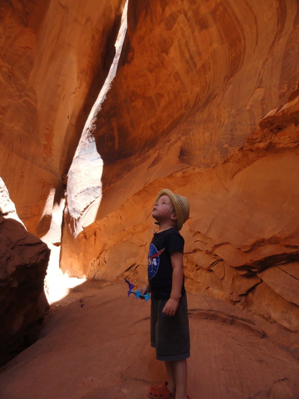
Cave Spring is a spring flowing out of the water, place that was inhabited long time ago by ancient Indian people, and then by cowboys taking advantage of green valleys of Colorado and Green River. There is even some furniture from cowboy times, some cans with bullet holes lying around (they look old but who knows)... It looks like a free campsite but a fence and a "do not touch" sign require respect. Maciek really liked it, especially due to the ladders we had to climb on a few parts of a trail and rock paintings - he seems to enjoy them a lot anywhere we see them.


Another attraction of The Needles is… the road to The Needles. It's really nice in Utah that distances don't mean a thing as no matter how far you go the roads are always scenic and picturesque.  "191" from Moab is Utah-standard. And "212", that leads directly to the park is a real pleasure for eyes. Rock formation we called icebreakers, cliff walls looking like middle-eastern temples and on top of that a Newspaper Rock.


Newspaper Rock is a rock used for hundered years by peoples of different cultures  to leave traces of their presence. There is a fence so you can't get too close, but still you can find on it a spaceship and a peace sign. . It's a must-see on a way to (or from) The Needles. Just next to it there are some trailheads mostly going into riverbeds. Most of them are long and difficult. We thought maybe they'd have some leaflets or maps in The Needles but they said BLM is in charge and they sent us to BLM office in Moab. It would be really nice if NPS and BLM could communicate just a little bit in this area...


Overall if we did it again we'd skip The Needles. If you take a southern route to Moab and you pass by it's worth to go those extra 35 miles to see them. Those with no kids who can hike more than us will probably not leave disappointed at all, but going there from Moab with two little kids was not the best idea ever. Even the view point which was really amazing is comparable to Island in the Sky and Dead Horse Point State Park. Newspaper Rock and the "212" are something worth seeing though.

At the end of this part Pawel would like to invite you to the workshop on "How to write 3.5 pages about a place not really worth seeing with kids cause it's too far and stuff unless you realize it might be once in a lifetime that you're in Utah".

One practical tip. We went to The Needles almost without any water, hoping that we'd fill up our bottles there. We did, no problem, but water from The Needles was almost as disgusting as water from Goblins. It tasted as if someone kept it in a plastic bottle left in the sun for much too long. Half of eight feet had some stomach problems afterwards. We're not sure if it was the water or too much civilization but just in case it's good to fill up your bottles somewhere else.

7/22/2013

In Smurfs' Pompei

Everyone who leaves Capitol Reef heading east faces the same dilemma. The goal is clear - to reach, sooner or later, Moab and two national parks - Canyonlands and Arches. But you can get there in two different ways - going further north on "24" to Interstate 70 and then down on "191". Or you can turn south from "24" onto "95" and get to Moab from exactly opposite direction. 


Both ways have their adventages. The only disadventage is that chosing either one you're missing all the fun parts of the other. Going south it's Hovenweep National Park, managed by BLM Cedar Mesa (both with numerous ancient Pueblo and Anasazi Indian artifacts and ruins). There is also Natural Bridges National Park and the most southern part of Canyonlands called The Needles. And if go a little bit more south on "261" and "163" you can even see Goosenecks State Park and Monument Valley considered by some people as one of the best places to see in the US.


The way north is shorther and the best place on it is Goblin Valley State Park. We decided to go north mostly because we realized we didn't have that much time any more. And we saw some pictures from Goblin Valley and we really liked them. We read that kids love it so we wanted to check whether Maciek is a regular kid at all (so far all our efforts in trying to make him love the nature as much as we do end up in his declarations about how much he loves cities and coffee places where he can eat cakes and drink juice).


On the junction of "24" and "95"we turned north. It's easy to find a place to camp there. To get to the park you have to turn from "24" onto Temple Mountain Road. Then you have to turn left again onto the road that leads to the park, while Temple Mountain Road keeps going straight.

Free campsites start at the very junction. You can either turn to the park and look for a dirt road leading to the rocks on your right. When we got there in the afternoon there were a few rvs there. Second option is to keep going on Temple Mountain Road. More or less 1000 feet further on the left there is a large parking with fire rings (although you won't find even a stick around...) and a toilet. We stayed there, first night with a few more rvs and couple of tents, second night it got more private. Further on there are a few more places like that.


Goblin Valley turned out to be exactly as great as we expected. It's a place that no travelers with kids (or those who are kids at heart) can not skip .Unfortunately our America the Beautiful pass doesn't work in state parks so we had to pay the fee: 7 USD per family. It was worth it. 


Comparing to all the great national parks of Utah, Goblin Valley seems to be a midget, funny scamp who crouched on the side. But it's a lot of fun for a whole day (as long as you can stand the burning sun). It consists of three valleys full of rock formations reminding Smurfs village turned into stone surrounded by town made of stone with spires like from a fairy tale. It's all amlost empty (crowd of people gathers near the parking and doesn't feel like going any further), and, what's best about it, among those smurfs' huts, goblins in funny hats and huge mushrooms there are no paved trails. You can go wherever you want and climb whatever you wish.


We wondered around the first valley for a long while, we didn't go much further as it was really hot and sunny and we didn't have too much water (practical tip: take a lot of water when you go there, as bottled water in the park gift shop is really pricey, there are no other stores in the area and tap water is very sandy and not tasty at all).

Those few hours we spent there were a lot of fun, especially for Maciek. He climbed the rocks, made us take pictures of him, run around, squeezed through natural windows, penetrated alcoves. Once or twice he slid on his butt but this didn't discouraged him at all. At the end we were exhausted and he kept climbing steeper and steeper hills dragging us behind.


And how was the Goblin Valley formed? It's an area where the erosion uncovered rock formations formed by sediments deposited by an inland sea some 170 millions years ago. Now water, wind, sun and so on keep lashing goblins making them into more and more unbelievable shapes.

White man discovered it only in 1920s. A guy called Artur Chaffin who owned a transporting company was looking for a shortcuts between Green River and Caineville and he came across the valley. He didn't share his discovery with the world right away, he came back 20 years later, took some pictures and as soon as he showed them to the world it became a tourist attraction. State of Utah quickly announced it a state park so the feds from Washington wouldn't steal another place from them.


A bonus attraction in the area is San Rafael Swell, which is a part of bigger formation called San Rafael Reef. By some people it is called the best hidden secret of Utah. There are no leaflets or brochures in visitors centers we visited in Utah. It seems like nobody took it for themselves yet, looks like BLM is in charge but doesn't really do much with it. It will probably change, as some time ago they started to distibute maps of the area in Goblin Valley SP visitors center.


San Rafael Swell is a stone wall with beautiful and not very popular hiking trails including two slot canyons considered the most beautiful in Utah (although there is usually a quick reminder that Buckskin Gulch, that we've seen earlier, is on Arizona territory).

We took a walk in one of these canyons, Little Wild Horse Canyon. It wasn't as picturesque as Buckskin, but it was still pretty amazing. In some places it was so narrow that Kalina could easily reach both walls at the same time. It turned out to be quite popular too so every few minutes we would pass by some families with kids or groups of students (it felt strange, seniors look now more natural on hiking trails for us).


Little Wild Horse Canyon can be hiked in a loop with Bell Canyon. It's around 8 miles, 4-6 hours walk. Too much for us. Besides, even on the easy part we walked, there were some huge stones to climb over. Without kids - no problem. With Kalina in a snuggly and pretty cooperative Maciek (he still dreams of coffee places with cakes and juice but he is better and better at jumping on the rocks) it was not that easy. 


Last but not least, one suggestion for really tough travelers. Just before the junction of Temple Mountain Road with "24" there is a gravel road to the right, leading straight to the horizon. It's a road to the Maze, the furthest and the most remote part of Canyonlands. To get there you have to be really well prepared. This gravel road goes for over 50 miles and a regular car should not drive there. Even those 4x4 cars should not take after rain.


We were not tough enough to try. The views are said to be amazing (which is not surprise anywhere in Utah), plus there are places on the way like Dirty Devil River. Green banks of that river and mazes of The Maze were favourite hidouts of many criminals of Wild West, including Butch Cassidy. Nobody wanted to go there to search for him...


From one of the most "backcountry" places of southern Utah we were just about to move to one of the most comercialized - Moab and two national parks nearby. Not to overdose civilization we found free camping and we got there just before dark.

8.5 miles before the Arches there is a road called Willow Springs Road turning left from "191". Less than a mile down this road the campsites start. It's quite a popular place but at the same time you keep your privacy. However the civilization is just around the corner. "191" to Moab is busy as a beehive, there is also a lot of trains going on a railroad there. But, as it was free, just a few miles from Arches and less than 30 miles from Canyonlands we can't complain…

7/19/2013

In Mother Nature's Workshop

Another day and another goodbye. This time we left scenic byway "12". We'd love to come back here some day, but this time with a reliable 4WD car. Or maybe without kids we won't worry that much about going into Utah's wilderness? If you ever get here don't limit yourselves to national parks, go off "12" and do some scenic byways.


Out of two backroads we skipped one was Smokey Mountain Road from Escalante to Lake Powell. As they wrote on utahcanyons.com, driving this high clearance track is no simple undertaking, it is rough and wild, so be well prepared. It goes by Smokey Mountain,which got its name from the century-old underground coal fire which still emits smoke, visible sometimes. If we were "Planet of the Apes" fans we'd go there for sure - some scenes were shoot there.


Another one we skipped was Hell’s Backbone Road. It was very tempting though. Built during Great Depression as an alternate road between Escalante and Boulder it's one of the most scenic backcountry byway in Utah. Part of it goes over a narrow ridge in the high country of the Aquarius Plateau with an amazing view of Box-Death Hollow (doesn't it sound tempting?). Maybe next time…


So we moved from "12" to "24" (scenic again). But leaving "12" is not that easy. Few miles before junction with "24" it climbs to over 9300 feet / 3000 m. View is amazing on both sides of the road. It's worth to drive there just to see it.


After driving so close to the sky we landed on the border of another National Park - Capitol Reef. Our campsite was quite popular which was not a surprise considering the views. There was few more rvs, but there was enough space for everyone.


There are two free campsites near Capitol Reef. One in just outside west border (it’s the one we chose). It’s easy to miss so it’s good to slow down, and after turning onto this dirt road it’s good to get out of the car to find a spot - there are a few roads to different spots and they are pretty rocky so be careful.

Second free campsite is just outside the park on the east. Take Notom Road, after half a mile take right and go up. The second one is on the open mesa so it probably has even better views than "ours" but it’s also more windy. When we drove by it was difficult to keep car going straight, and we and the campsite is higher and there is much more open spaces.


Capitol Reef is different than most of the parks we’ve seen so far: there are no shuttle buses, no crowds of people, no expensive restaurants and no "Capitol Reef Village". But it looks like Mother Nature’s workshop for building all other attractions in the area. There are so many colors, shapes, forms that it’s simply unbelievable. We didn’t get to see Hickman Bridge, a natural bridge known from postcards and leaflets as the road was closed due to rockslide. But even without it we really liked Capitol Reef.


It was called a Reef by the pioneers who had to cross it. It’s a very accurate name. The landscape goes easy for a while and then, suddenly there is a wall standing at the angle that makes it impossible to cross. You can try going around but it goes for over 100 miles. They had to cut through. Now it’s easier as Capitol Reef is crossed by interstate 80 and scenic 12, but in the old Times it must have been quite a challenge. And "Capitol" in the name comes from white domes over the reef made of Navajo sandstone.


Capitol Reef is also a west side of Waterpocket Fold, which is a wet depression in this part of Colorado Plateau. Rough, twisted and jagged top of the Reef was created during the uplift of plateu when rock layers got twisted. Wide valley emerged thanks to erosion and river Fremont which removed loose rock sediments. At least, that’s what we understood from the brochure. The final effect was both attracting (water and better climate than surrounding areas) and repulsive (difficult access). Although with the access it wasn’t so bad after all, first automobiles came not many years later after the first settlers.


Pioneers set up in the valley a very nice little town called Fruita near Fremont river. Now it’s a gate to Capitol Reef with visitors center. There are also orchards open to public. We read in one of the guidebooks that you can go in and pick some fruit for free. Than you have to pay for the fruit though… Well, let’s just say that in our country fruit picking is not an attraction yet so we wouldn’t do this even if it was a season …


We went for ice cream instead. Delicious and not expensive at all (price of ice cream in the US are unpleasant surprise every single time). And you can eat them at the yard of a 100-year old house with orchards and red stone views. Very good idea for a very nice afternoon.


Within Fruita, by "24", there is nice rock art. It's just by the parking and there is a boardwalk to the rock. Looking at the art you can conclude that Fremont people liked wide shoulders and fancy hats. Or they hated it. The best part of this art is that it is open to any interpretation. Some even think that most of it just a 19th century joke, because there is no good method how to evaluate the age of rock art.


Capitol Reef has also it’s scenic drive, which starts in Fruita and goes south. It is paved for a few miles and then it’s gravel. Going far south on 4WD only gravel road you can actually get to Burr Trail Road and you can go back to "12", if you are tough enough. We did miss a lot but we’re not tough at all. Maybe next time.

This time we took a look at uranium mines (as we're going east Capitol Reef is the beginning of the area where uranium and ecological points of view collided hard half way through 20th century). Then we hiked to Pioneers Register where at the end of 19th and beginning of 20th century pioneers and adventurers heading west would write their names on the wall of the canyon. This canyon was the first "highway" through the Reef and that’s how the first cars got to Fruita.


Most of the visitors of Capitol Reef sees only Fruita area and viewpoints on "24". But the park spreads much further to north and south from "24". We heard the trails are nice but not as pretty as for example Lower Calf Creek Falls, but going for an hour or two off the beaten path is really a true feast for eyes. 19 miles to the east from Fruita there is a road to the Cathedral Valley. It makes a loop going back via Harnet Road, but it’s almost 100 miles and part of it is a very sandy road that requires crossing a few creeks. We went just for a couple hours’ drive to Temple of the Sun, Temple of the Moon and Glass Mountain.

Glass mountain
We started with the latter one. It’s a small mound, maybe 10 feet tall, but it’s fascinating as it’s made of  selenite crystals - gypsum in the form of glassy crystals. From the distance it looks like tumulus honoring broken bottles. Temples are within a buttle's throw from the Glass Mountain. They are amazing. In the middle of flat valley there are two lone rocks - monoliths, composed of the earthy, buff-pink Entrada Sandstone, namely old mud, fragile and very brownish in sunset light.

Their loneliness and majesty have to bring religious associations, the names are more than accurate. As it was getting late and it was really windy we spent there more or less as much time as a second grader needs for morning prayer and we headed back.


Driving through the valley gives better understanding of all those names that stick to sacrum, going from devils to temples. Landscapes we saw there were so out of this world that they were escaping human categories. You can either fear them or feel the religious respect. Those places look like the world is being created there, there are naked, dead rocks next to green, fertile valleys full of fruit orchards. It’s hard to look and name all of them without religious terminology.

"We were here" - first travellers.
Unfortunately it was already too late to fully appreciate road to Notom. Notom Road goes south along the Reef. From there the whole formation is clearly visible. The view is so good that it made to the cover of park official brochure. We went just a few miles down the road, then sun went down and our memories from there will be based on the brochure …

Next day we spent going on the trails and viewpoints we missed before, including Sunset Point, from which you can see full selection of shapes and colors, and then, after a quick stop at a small shop with real bread and delicious cheese (on the right on "24" a few miles after you pass Cathedral Road) we headed on unbelievably scenic "24" towards next attractions.

7/17/2013

Stairway to Utah

It was beautiful in Dixie National Forest by the Red Canyon, but it was time to move on. Our next stop was the area of town called Escalante and the Grand Staircase-Escalante National Monument. It's a huge territory betwee "89" (south), Bryce (west), "12" (norh) and Capitol Reef (east). Almost 2 million acres of wilderness, canyons, rocks and old trails leading God knows where.


Grand Staircase has a very appropriate names. It is a grand staircase. In one of visitors center there was  a really good makieta, showing it. Staircase starts in Grand Canyon. As they said in one of the leaflets it is more than six thousand vertical feet of alternating cliffs, slopes, and terraces make up this giant staircase, which extends horizontally about 150 miles from the north rim of the Grand Canyon in northern Arizona to the top of the Paunsaugunt Plateau in southern Utah. Every stair of this staircase shows cliffs, amphitheatres. One can feel really small thinking how far it has to climb...


Despite we tried really hard finally we had to pay for camping, second time in Utah. And this is how it happened: we found a free campsite before (thanks to Marianne/Shunpiker Frugal Guide to Southern Utah), but as the area is within National Monument, to stay there overnight we needed a (free) permit from BLM. We stopped at BLM office in Cannonville to get it, but due to budget cuts it was closed on Mondays and Tuesdays. In the past Americans dealt with crisis by investing in national parks and public areas, now it looks they followed Europe's example and they cut costs. And the victims are of course the innocent by passers, like, in this case, us.


We thought for a minute what to do, we even went to the site we wanted to stay at. We thought that if we don't see a sign prohibiting overnight camping we'll stay and if someone ask we'd say we didn't know we needed a permit. But then we gave it up. There was a dirt road to the campsite, and a sign saying that in case of the rain the road is impassable. Meanwhile there was a dark cloud hanging over our heads. We took it as an omen and decided not to risk. 


So maybe a state park campground? For some reason we remembered that campground in Kodachrome State Park is 6 USD. It wasn't. It was 16 USD. For a site with no hookups? No, thank you. We ended up at paid campground in Escalante - for us it was less than 4 USD, because we used a coupon from Good Sam's Club for 25 USD discount. Plus a nice lady at the campground let us leave a trailer next day until the evening, so we could explore the area, change the oil in our car and charge everything that needed to be charged.


The town Escalante itself is not very interesting. It's proud of having the most impressive quarter of historic buildings from the end of 19th century and the beginning of 20th in Utah. It looks interesting on the map, but in reality the buildings often fall apart and are hardly visible from behind newer buildings or the bushes. But being in between national parks of Utah, Escalante is working really hard on its marketing... There is also a trail for a hike along Escalante river. Not worth it. After more or less an hour walk on a path among cows' poops we gave up. We should thank a snake that was crawling across the path for making this decision easier. 


For the next night we were better prepared. We got a permit from BLM (we've seen them later in boxes by the trailheads, so the visit to the office might be not necessary, but just to be on the safe side...). Lady in the office when we said we wanted a permit asked us where we wanted to camp. We pointed to the map - Burr Trail Road by Boulder. Oh, there is a pretty campground there, just 4 USD per night - she said. But we want for free, with no amenities or hookups - we said. That's perfect - she said - there are no hookups there. It was difficult to explain that we don't like to pay for something we can have for free…


Beafore we moved further to north-east we went on one more very back road called Hole-in-the-Rock Road. It's another example of Mormon obedience and perseverance to orders from SLC headquarters, namely Brigham Young. He thought of this road and he decided to cross wilderness of Utah woth a trail from Escalante south-east to one of the settlements there. He sent 200 settelers there and they built the road until they came across a tiny problem: Colorado river in a deep canyon. So they carved a hole in the rock - a road going slightly downhill to the river. From there they just needed a ferry and problem was solved. 


We drove just a little part of Hole-in-the-Rock Road to one of recommended trails in Escalante, called Devil's Garden. Whole road is almost 200 miles long and is really bumpy. We would get too tired and we wouldn't care for the beautiful views at the end, so we decided to skip it. But for those with better cars it might be an interesting trip. 


Devil’s Garden was one of the first devil's places on our southern Utah tour. It was getting a bit devilish in  Bryce Canion, but hell really starts east from Escalante. Trails over there have names like Satan’s Gut, there is also the favourite river of  Wild West outlaws like Butch Cassidy: Dirty Devil River.


Devil’s Garden is full of interesting rock formations, there are some mushrooms, some kinda-arches, some splashed shapes like from Picasso's paintings. Maciek had a lot of fun there. Besides you don't have to walk too far in the sun. Devil’s Garden is just by the parking. Another good thing about it is that Escalante is not an important stop for tourists in Utah, so there are no crowds there. By Devil’s Garden there are picnic tables, toilets and grills. We didn't take our picnic baskets with us, but it is a nice place for this kind of entertainment (the only disadventage is not enough shadow…).


Hole-in-the-Rock has much more tempting attractions. There are some nice slot canyons. We were tempted for a second but we were getting tired (Kalina is getting really heavy and she moves a lot so it's difficult to kcarry her in a snuggly), besides they were more than 14 miles from Devil’s Garden). There are also, of course, free campsites on Hole-in-the-Rock. We didn't stay there but if you ever need directions we know where to find them.


Escalante has more to offer in the area but we had to skip it as it was too far for us. There are Lower Calf Creek waterfalls we wish we could've seen. It's a 6-miles round trip walk. We made it to The Wave, but we would've made it crawling there. This time we passed. The road to the waterfall is very picturesue, there are also some Indian ruins and rock art. We've seen the canyon later on from "12", which runs above it, and it looks like a place we want to see some day.


We left the town of Escalante pretty late, after getting back from Devil’s Garden, and we moved not much further, to Burr Trail Road, just passed Boulder. It is also a very scenic road, first 30 miles is paved then it gets very narrow, steep, gravel and even more pretty. It leads, through the back door, to Capitol Reef National Park. We didn't try it as it's not recomended for trailers. 


But even those first few miles on Burr Trail Road was enough to be amazed. And the campsite was fantastic. After 5-5.5 miles from "12” there is a turn, just passed the speed limit sign saying 35. On the right there is a gravel  turnout and a large, old tree in the middle of the square. Under the tree there is a good spot for large rvs, Smaller rvs and tents can go a bit further, hide from the road and stay just by the wash. Peace and quiet (nobody goes there after dark), fire, stars...we miss it already...


Six miles further down the road there is a small slot canyon, or rather a slot in a tall rock, It's described in a leaflet about Escalante as "Long Canyon Slot”. It's really short, but it's charming. We went there on the next day. After that we hooked the trailer back to our car and we went on to Capitol Reef, which, as it is with those Utah names, is neither a Capitol, nor a Reef. But it wasn't difficult to figure out where the name came from…